It seems that researching for Korea trip is much tougher than I though. Breezing through the Taiwan researchs, I had underestimate this time round. Simply cannot find the directions by entering in English or Chinese!! While Google map was a god sent for Taiwan research, the same cannot be said for Korea.
Nearly smashed my PC while trying to find my way to 1 particular place. And so, I read that Naver Map was gives more accurate directions than Google. The only drawback is, it is all in Korean. Faints.
And so armed with Google translate, I proceed to translate every word on the app so that I can familiarise myself with the app. It took me a good half an hour to find the directions from A to B.
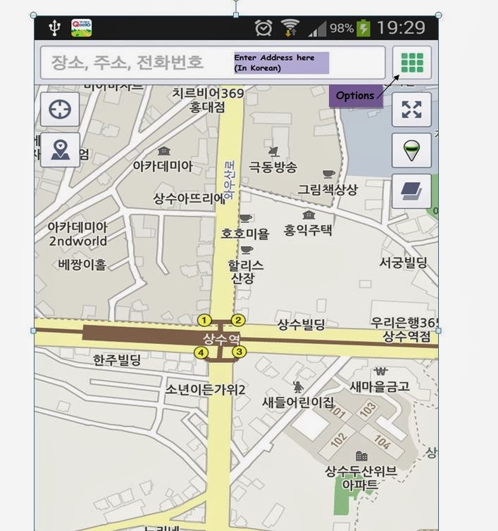 |
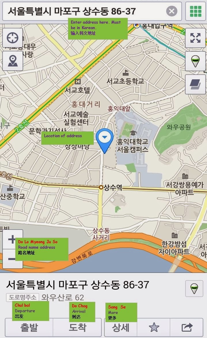
| To enter the address |
|
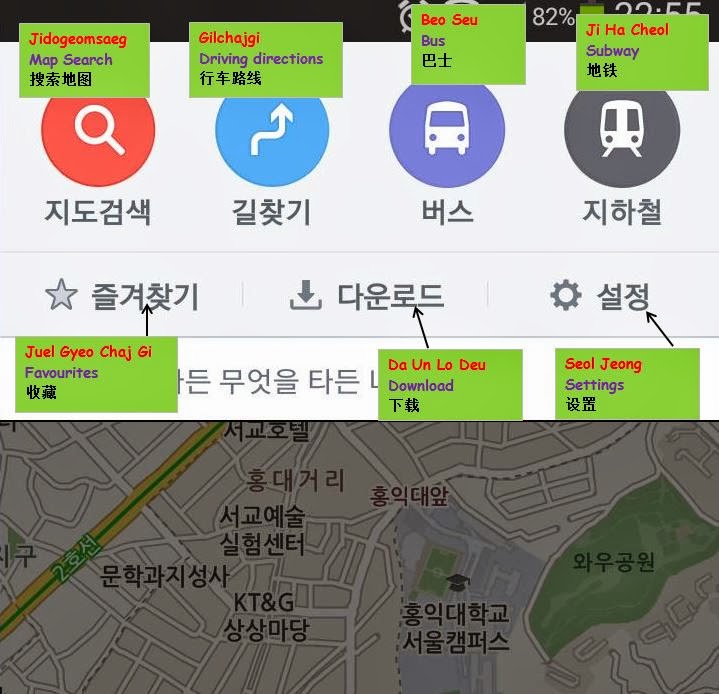
If you need more options, click on the 9-green sqaure icon where the options will be expanded.
Here, you can select different mode of transport i.e Driving, bus, train.
 |
| Selection of options |
After entering the address, the location will be shown on the map.
There are options to select this as Departure (Destination) or as Arrival.
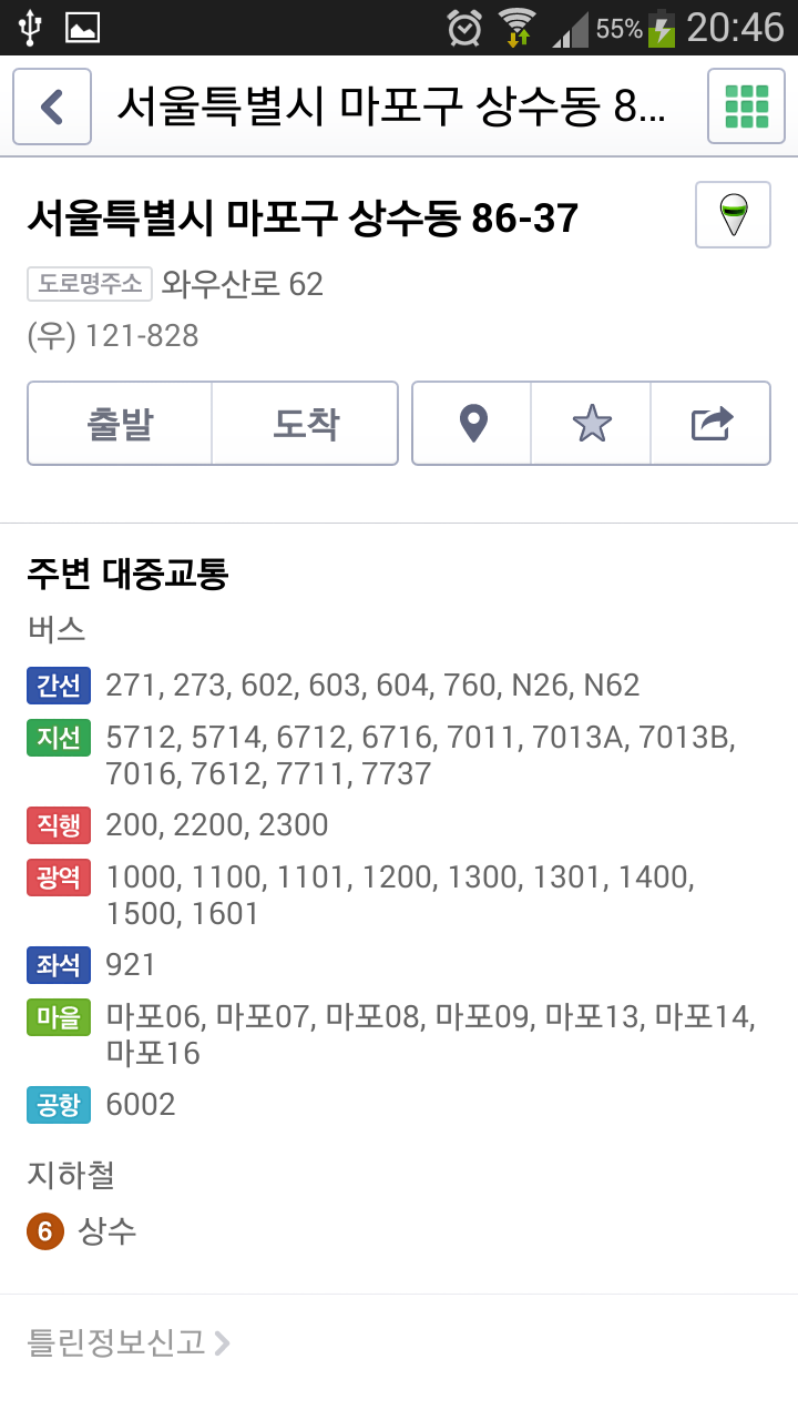
There is also a "More" where you can see the bus services to the destination and the nearest Mrt station.
 |
| Search results |
|
 |
| By selecting "More" |
By selecting "Arrival"(Do Chag), a screen will appear with the address at the destination(bottom) field. Then enter the staring point (in Korean)
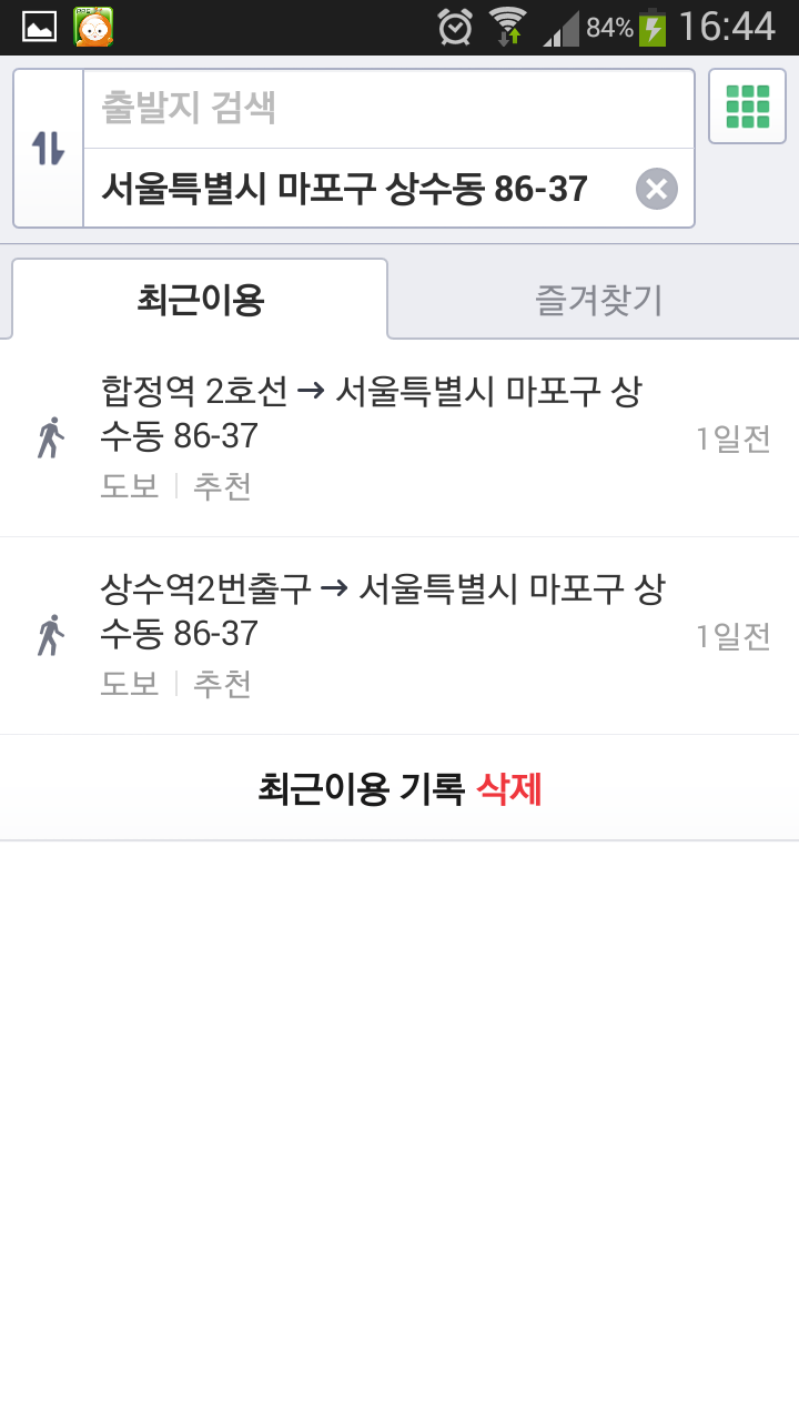 |
| Select as destination |
By setting as "Departure" (Chul Bal), a screen will appear with the address at the starting point (top) field. Then enter the destination in the bottom field.
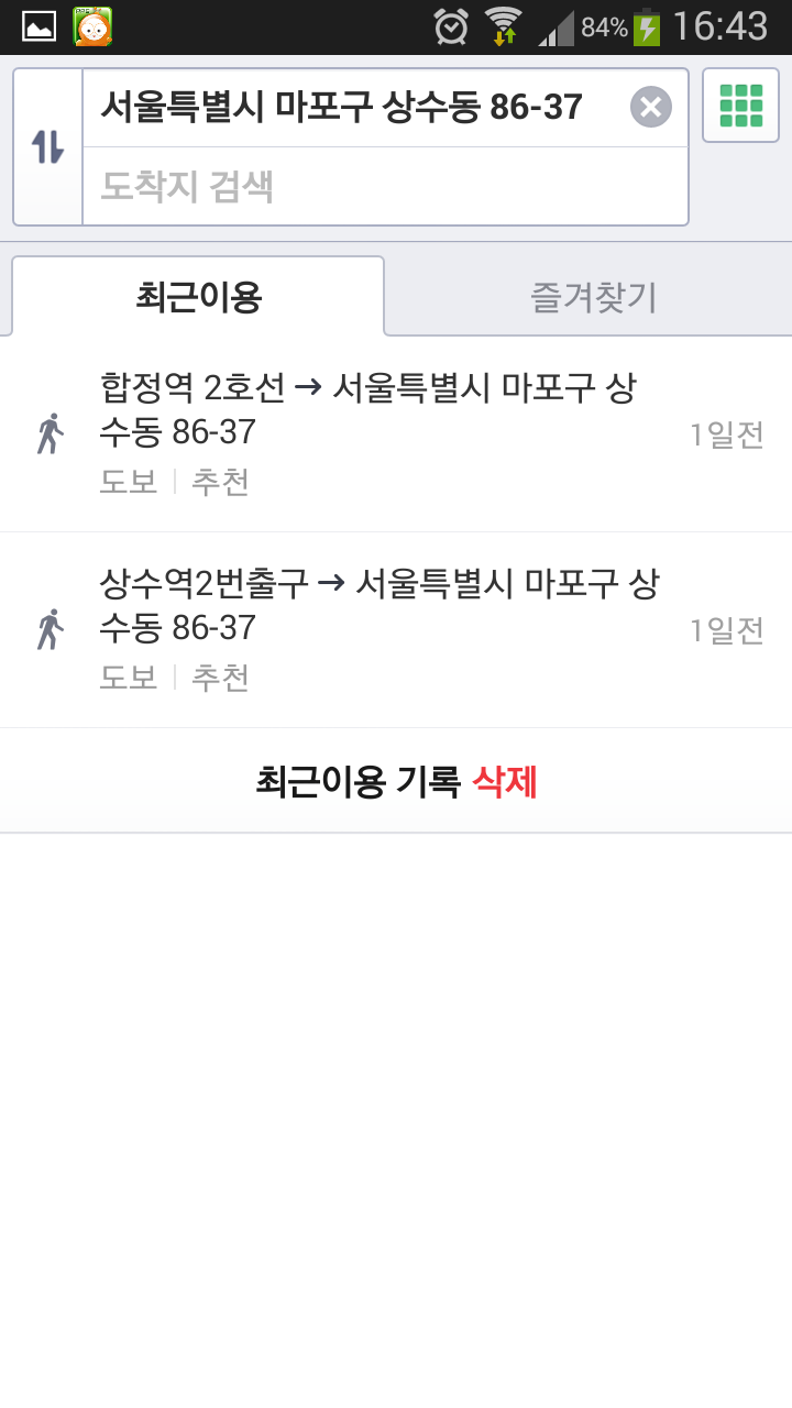 |
| Set as starting point |
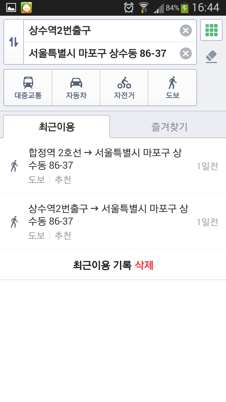
Once both starting point and destination are entered, if the addresses are valid, there will be selection for train, driving, cycle or walking routes to select.
Since I have entered starting point from a MRT station, I choose the walking route.
 |
| Search results |
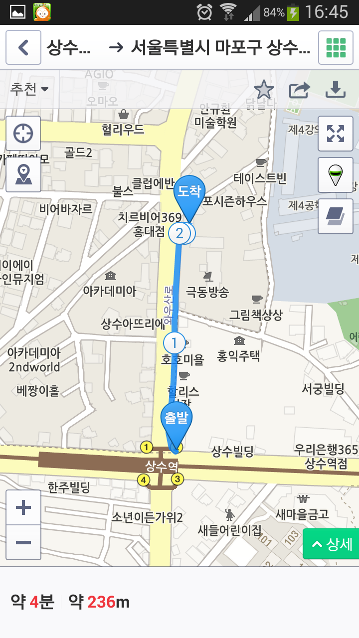 |
| Walking route |
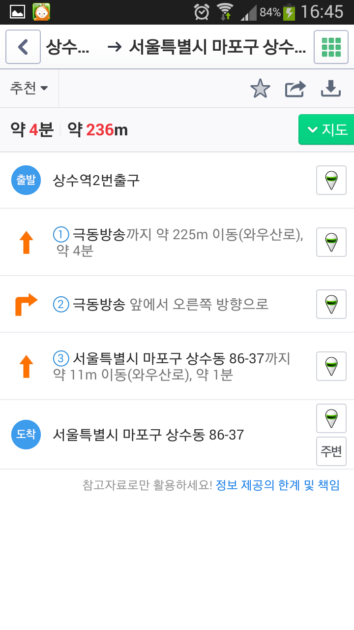 |
| Walking instructions |
|
|
|
|

No comments:
Post a Comment